OS Map: Title – The Peak District – The Dark Peak, Code OL1 (1:25000)
Start Grid Reference: SK 124853
Walk distance: 6.8 miles
Date walked: 13th September 2011
Time: 5 hours (including a lunch stop)
The walk up Grindsbrook Clough was the first I did in the Dark Peak back in 1965. That walk impressed me so much that I continued walking, mixed in with cycling and running, until the present day. I did that first walk in a new pair of Tuff boots; today its a new pair of Scarpa Terra GTX boots, well broken in this time.
The walk itself starts from the car park near the train station, goes into Edale village, more correctly known as Grinsdbrook Booth, up Grindsbrook Clough, skirts Kinder Scout, before coming down Jacob's Ladder back into the valley.
View Grindsbrook Walk in a larger map
When I first came to the village and for several years since, there was a cafe, made out of old railway carriages, selling pint mugs of tea . The Old Nag's Head pub was a real walkers' pub, and I still have memories of wet bleeding walker's feet being soothed with a pint by a coal fire. Both are still there, but changed to meet needs of the tea room and pub grub people of the 21st century.

The path to the Clough has changed too. It is no longer a muddy path, but a stone one.

Once the bridge across the Golden Clough is crossed the ascent up Grindsbrook begins.

Now Grindsbrook can be enjoyed.


There are no pictures of Kinder Scout as the wind was too strong to take anything decent. After we joined the Pennine Way, we stopped for lunch below Swine's Back and enjoyed the views down the Edale valley.

On this photograph the path down Jacob's Ladder can be seen winding its way down towards the valley.

Walking back down through Upper and Barber Booths our sunny, windy day turned to rain, but before it came the light was incredible.

So we ended the walk wet, but my new boots were brilliant and my feet were dry.
The walk up Grindsbrook Clough was the first I did in the Dark Peak back in 1965. That walk impressed me so much that I continued walking, mixed in with cycling and running, until the present day. I did that first walk in a new pair of Tuff boots; today its a new pair of Scarpa Terra GTX boots, well broken in this time.
The walk itself starts from the car park near the train station, goes into Edale village, more correctly known as Grinsdbrook Booth, up Grindsbrook Clough, skirts Kinder Scout, before coming down Jacob's Ladder back into the valley.
View Grindsbrook Walk in a larger map
When I first came to the village and for several years since, there was a cafe, made out of old railway carriages, selling pint mugs of tea . The Old Nag's Head pub was a real walkers' pub, and I still have memories of wet bleeding walker's feet being soothed with a pint by a coal fire. Both are still there, but changed to meet needs of the tea room and pub grub people of the 21st century.

The Old Nag's Head

Path to Grindsbrook Clough
Once the bridge across the Golden Clough is crossed the ascent up Grindsbrook begins.

Bridge over the stream at Golden Clough
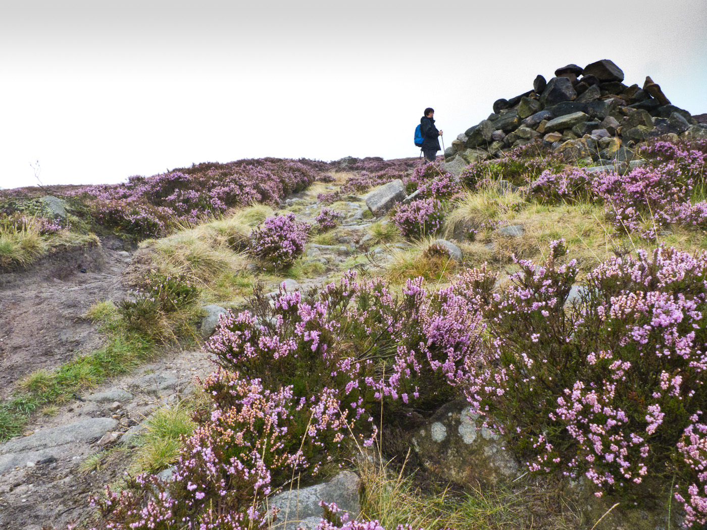
Now Grindsbrook can be enjoyed.

The final reaches of the Clough

View down Grindsbrook Clough

The cairn at the top of Grindsbrook
There are no pictures of Kinder Scout as the wind was too strong to take anything decent. After we joined the Pennine Way, we stopped for lunch below Swine's Back and enjoyed the views down the Edale valley.

Landscape view from Swine's Back
On this photograph the path down Jacob's Ladder can be seen winding its way down towards the valley.

Cairn at the top of Jacob's Ladder
Walking back down through Upper and Barber Booths our sunny, windy day turned to rain, but before it came the light was incredible.

Rain clouds over Lord's Seat
So we ended the walk wet, but my new boots were brilliant and my feet were dry.