Monday, November 19, 2012

Black Hill Circular Walk


OS Map: 1:25,000 Explorer Map OL1 The Dark Peak

Start Grid Reference: SE 018 094

Walk distance: 12 miles 

Date walked: 5th September 2012

Time: 5 hours

Route:  Self-planned 


Click here to view the map in OS Getamap

This is a walk close to my home and one that I haven't done for several years now.  It follows the  what used to be the good weather route for the Pennine Way over White Moss returning by the bad weather route down Wessenden Valley.  It seems now, according to the OS Map,  that the Pennine Way follows the bad weather route only.  The walk is fairly easy, but there are parts where true moorland walking will be experienced without artificial paths and the risk of sinking up to your knees in peat.

There are many places to start the walk, but I chose a convenient car park on the A62.  Very soon views of Pule Hill beyond Redbrook Reservoir.


Pule Hill above Redbrook Reservoir
There are many reservoirs on this walk providing water for canals or for drinking.  Beyond Black Moss reservoir the path follows the old Pennine Way route.


Black Moss Reservoir
From this reservoir there are views of Saddleworth and onto Manchester.  Leaving the official route of the Pennine Way, the path carries on over the peat bogs, but as the moorland becomes boggier and boggier a stone path has been laid.  I don't really like these artificial paths, but on the other hand if it helps support the moorland ecosystem, it is something I should accept.


Stone path over White Moss
The path reaches the A635 before it continues up to Black Hill.  It is not a steep climb, but the path is quite indistinct.  Now you will experience true moorland walking with peat and bog and it was more than on one occasion that I ended up to my knees as I failed to find the best route.
The route to the summit

The trig point on the summit of Black Hill
The route down from Black Hill follows the Pennine Way and therefore is very obvious before reaching Dean Clough and climbing back up to the A635.


Route down from Black Hill
Dean Clough
There is clear track now down the Wessenden Valley, where there is a series of reservoirs built around the turn of the century.


Wessenden Valley

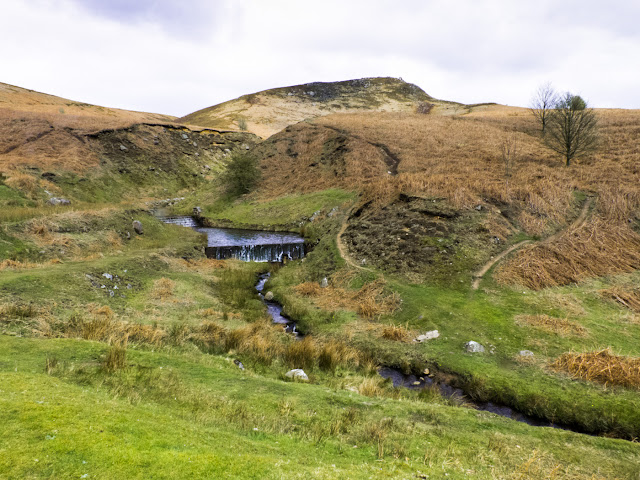
The path then crosses the water course and climbs back up to the moorland reaching Swellands and Black Moss Reservoirs.


Swellands Reservoir

Those, who like me, enjoy moorland walking will love this walk, particular on a day like this when the weather was fine and the sun was shining.  Those who do not and prefer solid paths may wish to avoid it.


Thursday, November 15, 2012

Changes to Steve's Walks

Since I started to put a few of my walks I undertake into this blog, I have always been a little unhappy using google maps as the only way to show them on the screen as you may be able to make out some of the paths on the satellite view, but not very clearly.  To improve things I started to include grid references at waypoints.  Now though I have discovered and subscribe to getamap from the Ordnance Survey.  So in future I will be including links to those maps rather than google maps.  There will be some differences.  You will find that notes giving directions of the walk on the map will not be present, but you will have access to a route card which gives grid references for way points along the route.  To access the maps and route cards you will have to register - it's free.  For full access, including enhanced printing facilities, there is an annual subscription fee.

Tuesday, September 18, 2012

Ben Hiant Walk


OS Map: 1:25,000 Explorer Map 390 Ardnamurchan

Start Grid Reference: NM 555 629

Walk distance:  5 miles

Date walked: 1st June 2012

Time: 4 hours approximately

Route:  Taken from Walks - Mallaig and Ardnamurchan (publ. Hallewell - www.pocketwalks.com) available from Amazon.  


View Ben Hiant Walk in a larger map

This is the last of the walks I'm blogging from our stay at Mingarry Lodges in Scotland at the end of May.  It is quite a hard walk and I would advise that it should only be undertaken in good weather conditions.  I think it is also a good idea to take a compass or GPS with you, I found my GPS particularly useful.  Although hard, it is an incredible walk and from the summit you have magnificent views from the inner hebrides to Loch Sunart.

Although the walk starts by following a vehicle track, very soon you reach the open hillside with red deer up on the ridge.


Red Deer on the ridge

 There are magnificent views over Loch Sunart throughout the walk.


Loch Sunart
The ascent in this direction is hard work with much of it on rough terrain, where sheep tracks provide the easiest walking.  The next two photos show views from the summit.


Panorama from the summit 
The path down is on the other side of the hill from the ridge walk you take to the summit from where it is easily visible

The descent path seen from the summit of Ben Hiant
The view of the summit on the way down is completely different to the ascent.  It looks much more foreboding.
The summit of Ben Hiant during the descent.
Arriving at the road, there is another car park, which could be used as an alternative.  An alternative route to climb Ben Hiant would be to  simply use the descent path to go up as well as down.  It is one we did several years ago when our children were with us.  The route we took today is much more rewarding, although it unfortunately it had to end with a walk along the road back to where we left the car.

Saturday, July 14, 2012

Castle Tioram Walk


OS Map: 1:25,000 Explorer Map 390 Ardnamurchan

Start Grid Reference: NM 664 721

Walk distance:  4 miles

Date walked: 29th May 2012

Time: 2 hours approximately

Route:  Taken from Walks - Mallaig and Ardnamurchan (publ. Hallewell - www.pocketwalks.com) available from Amazon.  


View Castle Tioram in a larger map


This is another of the walks we completed during our stay at Mingarry Lodges in Scotland at the end of May.This is a great short walk.  It starts at a car park near to Tioram Castle, follows the coast overlooking Loch Moidart, then rises to small lochans on the moors before descending back to the car park.


The Castle dominates the beginning and end of the walk.  We completed the walk then wen to visit the castle.


Castle Tioram
It can be accessed at the beginning or end of the walk by a strand, but care should be taken as the castle can become cut off at higher tides.  They will determine when you visit or whether you visit at all.


Access to the Castle
The first part of the walk follows the coast on a clear path.  At times it can be overgrown, but as we experienced it is kept clear.  This part of the walk affords wonderful views over Loch Moidart.

Tioram Castle in Loch Moidart

View over Loch Moidart
The path leaves the coast at a small cairn.  Over the ridge there are beautiful views over small lochans.  Here we sat and watched a pair of cuckoo fly and call to each other.


View from the ridge

Lochan na Fola
The paths now descends by the side of a reservoir back to the coast.


View over South Channel at the end of the walk
This was a walk we fitted in the afternoon.  It is one of those walks: small enough to fit into a day when you are busy doing other things, but more than rewarding in that it gives you great views, some history and the peacefulness of the Scottish moors.


Friday, July 6, 2012

Peanmeanach Walk


OS Map: 1:50,000 Landranger 40 Loch Shiel

Start Grid Reference: NM 742 836

Walk distance:  6.5 miles

Date walked: 27th May 2012

Time: 4.5 hours approximately with a long lunch

Route:  Taken from Walks - Mallaig and Ardnamurchan (publ. Hallewell - www.pocketwalks.com) available from Amazon.  


View Peanmeanach Walk in a larger map


At the end of May and the beginning of June, we spent a great week just outside Acharacle in a self catering lodge (www.mingarylodges.co.uk).  It was a great place for wildlife - Pine Martens in the garden - but also a great location for walking.  All the walks we did were taken from the same publication, this and the next few posts will describe some of them.


This walk was undertaken on a very hot day in May.  It is not very long but with the weather conditions, it  was more arduous than we thought it would be.  The walk gives magnificent views over the Sound of Arisaig, Loch Nan Uamh and the islands beyond.  Inland, there are views of and the walk goes by Loch Doir a' Ghearrian.  The destination of the walk is Peanmeanach a deserted settlement by the sea.


Railway Bridge
The path is crossed by one of the most beautiful train lines in the country - some say the world.Crossing it does not present any difficulty at all, if you are walking that is.


After a period of walking through woods, the walk opens out to reveal a wonderful vista.


View over Loch Nan Uamh

View over Loch Doir Ghearrain
Before reaching the abandoned settlement, the path goes by the edge and through another wood.  The approach to Peanmeanach is through a flat area of marsh grass.


Approach to Peanmeanach


At the coast, there are ruins of the old Peanmeanach settlement and a bothey, which can be used as accommodation.  It is also a great place for camping.

Peanmeanach Ruins.
Peanmeanach Coastline
Great place for camping

Although it was very hot, this was a very enjoyable walk.  I am not a fan of there and back walks, but to complete this one, I'm afraid you will have to retrace your steps back to the car.  However the hardship is not great when you have repeat the experience of these wonderful views.


Thursday, June 14, 2012

Embsay Crag Walk


OS Map: 

Start Grid ReferenceGR:  SE 010 538

Walk distance:  7 miles

Date walked: 28th April 2012

Time: 3 hours approximately

RouteSelf planned.


View Embsay Crag Walk in a larger map


This walk starts from the village of Embsay (the home of the Embsay Steam Train) a short distance from Skipton.  This is the first time I have walked on Embsay Moor and was really impressed with the Crag and the moorland walk.  In the main the walk is fairly straight forward, although there are a couple of places little more care in following the route needs to be taken.  These are pointed out on the map.

Start of the Walk

The walk starts by going through the field (with sheep on our walk) at the back of the car park.

View towards Embsay Crag

There are two features that dominate this walk the Crag and the Embsay Moor Reservoir.

View over Embsay Moor Reservoir from Embsay Crag.

Past the Crag, the walk takes you up onto the moors.  This is one of the places where care needs to be taken (see map Waypoint 6).  These moors are grouse shooting moors and, before turning left from the broad track, you will find a two turf-roofed buildings with tables and chairs for the shooters.

Shooting huts

Now the walk follows the track to the shooting buts, beyond which the path becomes less distinct, but it is not difficult to reach the path by the reservoir.  By now the clouds had cleared somewhat and we had more great views of the Crag and the Reservoir.

Embsay Crag over Embsay Moor Reservoir

This walk was fitted in to coincide with a visit to Skipton.  It was an area I was unfamiliar with, being more familiar with the Dales further north, so it was a surprise that it was such an enjoyable walk and an area I will certainly return to.


Tuesday, April 24, 2012

Standedge - Windy Hill Circular Walk


OS Map: South Pennines, Code OL21 (1:25000)

Start Grid Reference: SE 183 095

Walk distance:  12 miles

Date walked: 15th April 2012

Time: 4.75 hours approximately

Route: Self planned.

Most of the this walk is on the OS Map OL21 apart from the first few hundred yards, which is on OS Map OL1.  However, this part of the walk is very easy to negotiate without a map or at least with the google map.  It starts from the car park by Brun Clough Reservoir.  It is a free car park so no change is required.


View
The waypoints on the map have 10 figure grid references for use with GPS devices

This walk gives you a real moorland experience with views over Saddleworth and Lancashire.  This landscape needs to be experienced, I have never really been able to capture it in photographs.  Therefore for this walk there are fewer photos than usual.

Views from Standedge


Another view from Standedge
Not all of the walk is on the moors.  The middle part drops down to an area with many reservoirs.  Piethorne Reservoir is particularly picturesque with a Lancashire Wildlife Trust's reserve in the wood on its northern shore.

Piethorne Reservoir

Norman Hill Reservoir


Just beyond the telecommunication masts on Windy Hill the walk joins the Pennine Way which leads you all the way back to the car park by Brun Clough Reservoir.  Unfortunately there are no refreshments at the car park but there are two pubs, the Great Western and the Carriage House, a few hundred yards along the A62 in the direction of Huddersfield.

Monday, April 23, 2012

Win Hill Circular


OS Map: Title – The Peak District – The Dark Peak, Code OL1 (1:25000)

Start Grid Reference: SK 171835

Walk distance:  6.8 miles

Date walked: 21st September 2011

Time: 5 hours approximately


Route: Taken from Walking in Derbyshire by Elaine Burkinshaw published by Cicerone

I first came to the Dark Peak in 1965, when I experienced the beautiful Lose Hill, Mam Tor, Lord's Seat ridge walk and the remote Kinder plateau.  That was the first time I saw Win Hill in the distance, but until this walk had never reached its summit.

The walk starts from the car park in the middle of Hope, there is a small charge so change is needed.


View Win Hill Circular in a larger map

The walk takes the road along the Edale Valley, then leaves it to cross the River Noe and go under the railway.  The path eventually leads to Titchwell Farm.  Following the edge of the wood the path opens up to reveal views of the Vale of Edale.
View from above Titchill Farm
View along the Vale of Edale

Lose Hill - Mam Tor Ridge


Above Titchill Farm the path actually walks away from Win Hill before turning back on itself to lead you to its 'peak'.  Only 426m high it seems higher and on this day in September it was extremely windy.

Approach to Win Hill

Trig Point on top of Win Hill

The walk takes you down from the hill, through the village of Aston to Hope Railway Station, where down the line you are rewarded with more views of Lose Hill.


View from Hope Station
The last bit of the walk takes you past the remains of the Navo Roman Fort.  I think they are just a few stones near this stile.


Site of the Navo Roman Fort.


The walk ends back at the car park, where you will be able to spend some time wandering around Hope Church.


Hope Church


Back in 1965 having completed my first walk in and around Edale Valley (30 miles), we stopped at Hope for a plate of beans on toast and a cup of tea.  That cafe is no longer there, but there are several more to reward yourself for completing a very pleasant walk.