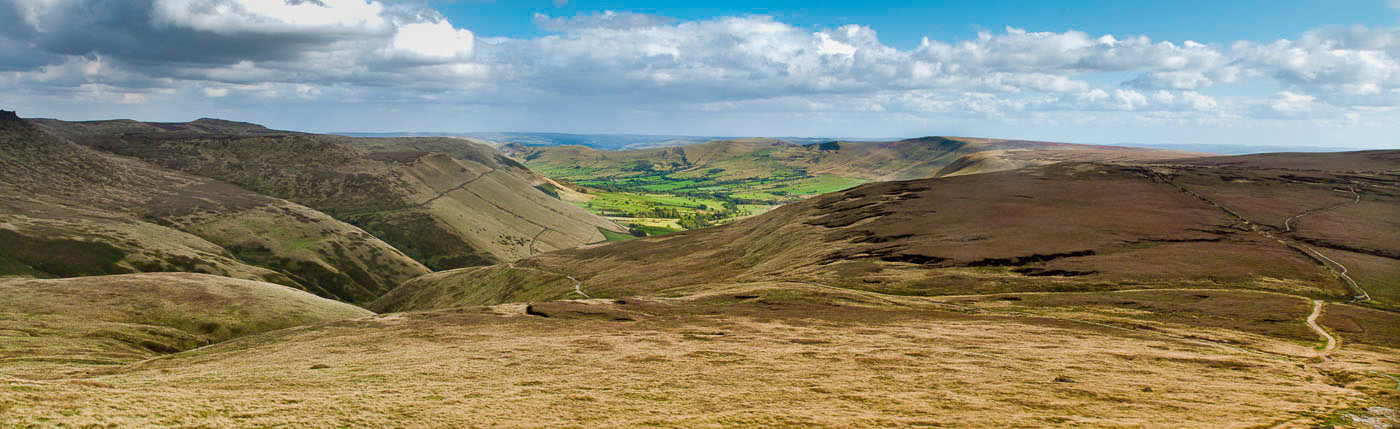
Showing posts with label Walks. Show all posts

Friday, April 12, 2013

Jervaulx Abbey Circular Walk


OS Map: OS Explorer Map (1:25 000) Northallerton & Thirsk -  Sheet 302

Start Grid Reference: SE 169 856

Walk distance: 7 miles 

Date walked: 5th April 2012

Time: 3 hours


After a winter of illness and little walking, I am now in better health and able to tackle some routes again.  This is a 7 mile circular walk taken from the Where2Walk website, which starts and finishes at Jervaulx Abbey, takes in Thornton Steward and ends with a lovely walk along the River Ure.

The walk starts in the car park opposite the abbey, where there are tearooms for refreshments if needed.  There is a charge of £1 for parking payable in the honesty box at the car park entrance.

Jervaulx Abbey
As the walk starts and ends at the Abbey, you can explore the ruins before or after your walk.  It is £3 to enter the ruins, once again paid into an honesty box.

Grounds of Jervaulx Abbey
At the start of the walk, sheep were grazing on the wide expanse of grass in the grounds of the abbey.  The bridleway is clearly marked and the path takes you through the grassland.  As you walk through the grounds you pass by a small lake.

Lake in the ground of Jervaulx Abbey

After the grounds of the abbey, there is a short stretch of road to take you across the River Ure.

The River Ure


Shortly after the bridge the path goes through farmland to reach Thornton Steward.  Thornton Steward in a quiet very old village, friendly to ramblers.  The Community Hall provides tea and coffee on a self serve basis and there is also a ramblers' toilet.  Donations are requested to maintain this very welcome service.  From the village, the track goes down to St. Oswald's Church; there are alternative paths to the church if you wish.

St Oswald's Church
From the church the route now takes you by Danby Hall, the home of the historical Scrope Family, then to Danby Low Mill with views of Great Whernside beyond.

Danby Hall

Danby Low Mill
 After another short road walk, the Ure is crossed once more before following the river embankment back to the abbey.  When we walked it, the river was good for birds with the usual mallard and moorhen, but also a pair of goosanders.  A mute swan was also nesting on the fishpond. 

Fishpond by the River Ure
The path continues along the river before turning up to the road at the abbey.

This is a gentle walk, which can be undertaken by the whole of the family and short enough to still allow time in the day to explore some of the lovely Dales' towns and villages.

Tuesday, September 18, 2012

Ben Hiant Walk


OS Map: 1:25,000 Explorer Map 390 Ardnamurchan

Start Grid Reference: NM 555 629

Walk distance:  5 miles

Date walked: 1st June 2012

Time: 4 hours approximately

Route:  Taken from Walks - Mallaig and Ardnamurchan (publ. Hallewell - www.pocketwalks.com) available from Amazon.  


View Ben Hiant Walk in a larger map

This is the last of the walks I'm blogging from our stay at Mingarry Lodges in Scotland at the end of May.  It is quite a hard walk and I would advise that it should only be undertaken in good weather conditions.  I think it is also a good idea to take a compass or GPS with you, I found my GPS particularly useful.  Although hard, it is an incredible walk and from the summit you have magnificent views from the inner hebrides to Loch Sunart.

Although the walk starts by following a vehicle track, very soon you reach the open hillside with red deer up on the ridge.


Red Deer on the ridge

 There are magnificent views over Loch Sunart throughout the walk.


Loch Sunart
The ascent in this direction is hard work with much of it on rough terrain, where sheep tracks provide the easiest walking.  The next two photos show views from the summit.


Panorama from the summit 
The path down is on the other side of the hill from the ridge walk you take to the summit from where it is easily visible

The descent path seen from the summit of Ben Hiant
The view of the summit on the way down is completely different to the ascent.  It looks much more foreboding.
The summit of Ben Hiant during the descent.
Arriving at the road, there is another car park, which could be used as an alternative.  An alternative route to climb Ben Hiant would be to  simply use the descent path to go up as well as down.  It is one we did several years ago when our children were with us.  The route we took today is much more rewarding, although it unfortunately it had to end with a walk along the road back to where we left the car.

Monday, April 23, 2012

Win Hill Circular


OS Map: Title – The Peak District – The Dark Peak, Code OL1 (1:25000)

Start Grid Reference: SK 171835

Walk distance:  6.8 miles

Date walked: 21st September 2011

Time: 5 hours approximately


Route: Taken from Walking in Derbyshire by Elaine Burkinshaw published by Cicerone

I first came to the Dark Peak in 1965, when I experienced the beautiful Lose Hill, Mam Tor, Lord's Seat ridge walk and the remote Kinder plateau.  That was the first time I saw Win Hill in the distance, but until this walk had never reached its summit.

The walk starts from the car park in the middle of Hope, there is a small charge so change is needed.


View Win Hill Circular in a larger map

The walk takes the road along the Edale Valley, then leaves it to cross the River Noe and go under the railway.  The path eventually leads to Titchwell Farm.  Following the edge of the wood the path opens up to reveal views of the Vale of Edale.
View from above Titchill Farm
View along the Vale of Edale

Lose Hill - Mam Tor Ridge


Above Titchill Farm the path actually walks away from Win Hill before turning back on itself to lead you to its 'peak'.  Only 426m high it seems higher and on this day in September it was extremely windy.

Approach to Win Hill

Trig Point on top of Win Hill

The walk takes you down from the hill, through the village of Aston to Hope Railway Station, where down the line you are rewarded with more views of Lose Hill.


View from Hope Station
The last bit of the walk takes you past the remains of the Navo Roman Fort.  I think they are just a few stones near this stile.


Site of the Navo Roman Fort.


The walk ends back at the car park, where you will be able to spend some time wandering around Hope Church.


Hope Church


Back in 1965 having completed my first walk in and around Edale Valley (30 miles), we stopped at Hope for a plate of beans on toast and a cup of tea.  That cafe is no longer there, but there are several more to reward yourself for completing a very pleasant walk.

Thursday, October 13, 2011

Grindsbrook Walk

OS Map: Title – The Peak District – The Dark Peak, Code OL1 (1:25000)

Start Grid Reference: SK 124853

Walk distance:  6.8 miles

Date walked: 13th September 2011

Time: 5 hours (including a lunch stop)


The walk up Grindsbrook Clough was the first I did in the Dark Peak back in 1965.  That walk impressed me so much that I continued walking, mixed in with cycling and running, until the present day.  I did that first walk in a new pair of Tuff boots; today its a new pair of Scarpa Terra GTX boots, well broken in this time.


The walk itself starts from the car park near the train station, goes into Edale village, more correctly known as Grinsdbrook Booth, up Grindsbrook Clough, skirts Kinder Scout, before coming down Jacob's Ladder back into the valley.


View Grindsbrook Walk in a larger map


When I first came to the village and for several years since, there was a cafe, made out of old railway carriages, selling pint mugs of tea .  The Old Nag's Head pub was a real walkers' pub, and I still have memories of wet bleeding walker's feet being soothed with a pint by a coal fire.  Both are still there, but changed to meet needs of the tea room and pub grub people of the 21st century.


The Old Nag's Head


The path to the Clough has changed too.  It is no longer a muddy path, but a stone one.


Path to Grindsbrook Clough


Once the bridge across the Golden Clough is crossed the ascent up Grindsbrook begins.


Bridge over the stream at Golden Clough


Now Grindsbrook can be enjoyed.


The final reaches of the Clough


View down Grindsbrook Clough


The cairn at the top of Grindsbrook 


There are no pictures of Kinder Scout as the wind was too strong to take anything decent. After we joined the Pennine Way, we stopped for lunch below Swine's Back and enjoyed the views down the Edale valley.


Landscape view from Swine's Back


On this photograph the path down Jacob's Ladder can be seen winding its way down towards the valley.


Cairn at the top of Jacob's Ladder


Walking back down through Upper and Barber Booths our sunny, windy day turned to rain, but before it came the light was incredible.


Rain clouds over Lord's Seat


So we ended the walk wet, but my new boots were brilliant and my feet were dry.


Saturday, September 3, 2011

Ashop Edge Walk

OS Map: The Peak District, Dark Peak Area, OL1 (1:25000)

Start Grid Reference: SK 109915 
Walk distance: 8.4 miles 
Time: 4 hours (approx.)


View Snake Pass Walk in a larger map


This is a walk that takes you around the edge of that great peat plateau Kinder Scout.  The car park is on the Snake Pass (A57).  From the car park the path goes through the wood on the other side of the main road. After a short distance the path through the woods comes into the open.  It then turns back on itself to follow the stream.

Ashop Clough - the view after emerging from the wood


Looking down the clough

Towards Ashop Head
 Walking up the clough, we saw grouse on the moorland on each side and heard golden plover, but unfortunately none were seen.

At the head of the stream, at a crossroad of footpaths, the path takes the route of the Pennine Way.

View up to Kinder Scout
Our path takes the opposite direction to this, but it is a continuation of the Pennine Way.  After crossing the Snake Pass, the path continuous on the other side to another crossroads of paths.  Here it turns right back to the road.  We followed the road back to the car park.  The map shows another path on the other side of the road leading through the woods.  While we could make it out below, we completely missed its beginning.

Less than a mile down the road, the Snake Inn will provide you with well-deserved sustenance after a very enjoyable walk.

Wednesday, April 7, 2010

Claife Heights Walk


OS Map: The English Lakes South Eastern area (1:25000)


Start Grid Reference: SD 381953
Walk distance: 5.8 miles 
Time: 3 hours (approx.)


This is gentle walk that starts from the village of Far Sawrey and takes you over land originally owned by Beatrix Potter, through woods that overlook Lake Windermere and Bowness on the other side.


View Claife Heights in a larger map


Finding your way around this walk is straight forward. Any difficulties you may encounter are identified on the map. For me the best part was walking by Moss Eccles and Wise Een Tarns.
Moss Eccles Tarn

Wise Een Tarn

Heald Wood

Sunday, June 7, 2009

West Burton Walk


OS Map Reference: Yorkshire Dales Northern & Central areas (1:25000)

Start Grid Reference: SE 017868
Walk distance: 5.3 miles
Time: 3.5 hours (approx.)


This is a lovely walk from West Burton one of the most beautiful villages in the Dales. The walk takes you down valley of Bishopdale Beck to near New Biggin, then over the hill to come back to the start down the Walden Beck Valley. It is a fairly easy walk that presents you with a real 'Dales' experience.


View West Burton Walk in a larger map


The walk start from the Fox and Hounds Inn - a very nice place to spend the weekend. There is car parking on the road in the Village


From the pub, follow the road out of the village until you reach a track to take you along the valley with Bishopdale Beck at the bottom.

The path is very obvious and, as you walk along, it you are presented with classic views of Dales' fields and their barns.


After the fourth field the path splits. Take the right fork, which leads you away from the wall on your left. After passing across several fields you eventually reach a lane, which comes out just above the village of Newbiggin. There are only dwellings here, but it will only take a couple of minutes to see it.

Here take the track to the left. If you wanted to, you could have left the track earlier to take a path up the hill. Taking the track on the left, it bends to the left. Follow it until you cross a small stream, where the path goes up the hill.


At times the path is not obvious, but if you keep the stream on your right, particularly when you reach the open ground, you will reach the edge of the forest. The path goes into the forest at angle until the road is reached. When I did the walk, the forest was not accessible due to tree felling. However I was able to follow the forest perimeter until the road was reached.

Turn right at the road and follow it for several yards. After a double bend take the path (track) on the left that leads down to Cowstone Gill House.


The path itself leaves the track. Head to the left of the house to find the route beyond. This part of the walk is not obvious. To find the route initially a 1:25000 OS map is important, simply to find the stiles in the stone walls. It is not too long, however, before the path is obvious and you encounter typical Dales' plants and animals as you walk down the valley of Walden Beck.


After several fields, take the path to the right to bring you to the road at Cote Bridge. At the road turn left into the village and if it's the right time of day a pint in the Fox and Hounds.

Wednesday, March 26, 2008

Farnley Tyas - Thurstonland Walk

OS Map Reference: 288 Bradford & Huddersfield (Explorer Series)

Start Grid Reference: SE165128

Walk distance: 5.5 miles

Time: 4.5 hours (approx.)

This walk is based on an article published in the Huddersfield Examiner published on 23rd February. However, the route in the paper is inaccurate and takes you over private land. The directions I give are accurate and follow public rights of way as printed on the OS map.


Ten minutes into the walk and the path from Farnley Tyas over the fields is easily visible.
Thurstonland can soon be seen in the distance, but it will be some time before we get there.


The path from Brown's Knoll Road (Placemark 5) takes you in the direction of Emley Moor television mast.


Just before the railway (Placemark 8), there is a bridge over this stream in the woods. It makes a nice place to stop and take a break.


Later on the walk gives good views of the hills beyond Meltham.


The walk takes you near Thurstonland Church with Emley Moor beyond.


Through out the walk Emley Moor Mast is a constant companion, but not a close one as in this picture.